")
")
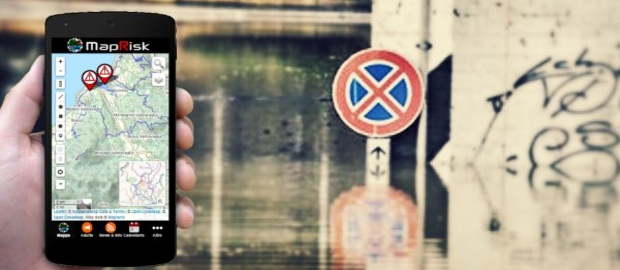
MapRisk is the first App by MapLand, specially designed and created to manage the activities of civil protection:
1 - Ensure the dissemination and knowledge of the Emergency Plans;
2 - Allowing the spread of activities, warnings, notices relating to civil protection;
3 - Plan and manage the structures and organizations of civil protection in ordinary time and in emergency
The heart of MapRisk, according to the spirit of MapLand, is the WebMap, which have the great advantage of providing useful information in a direct and necessary
or the management of the structures: identify risks and issues, resources and emergency actions on its territory, etc .
If you are interested, write to: This email address is being protected from spambots. You need JavaScript enabled to view it.